Vertical datums
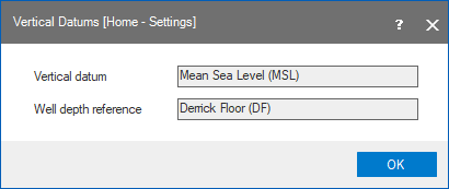
You can use the Vertical Datums form (Home > Settings) to review the vertical datum and the well reference depth for your JewelSuite Subsurface Modeling project. This form is not editable.
Vertical datum Lists the vertical datum, where the elevation is zero. Mean Sea Level (MSL) is the assumed permanent vertical datum for all data imported to JewelSuite. You can import data referenced to any permanent vertical datum, e.g. Lowest Astronomical Tide (LAT). Please note that it is geodetically risky to mix data referenced to different vertical datums within a solution or between solutions.
Well depth reference Lists the well reference depth, where the Measured Depth (MD) and the True Vertical Depth (TVD) is zero. Derrick Floor (DF) is the assumed depth reference point for all well data imported to JewelSuite. You can import well data referenced to another reference depth, e.g. kelly bushing (KB). Please ensure that the elevation of the reference depth is entered as the ‘Derrick Floor Elevation (DFE)’ for the well.
On the Vertical Datums form, you can review the vertical datum and well reference depth for your project. This form is not editable. click to enlarge